Pedra da Gavea Hike Guide
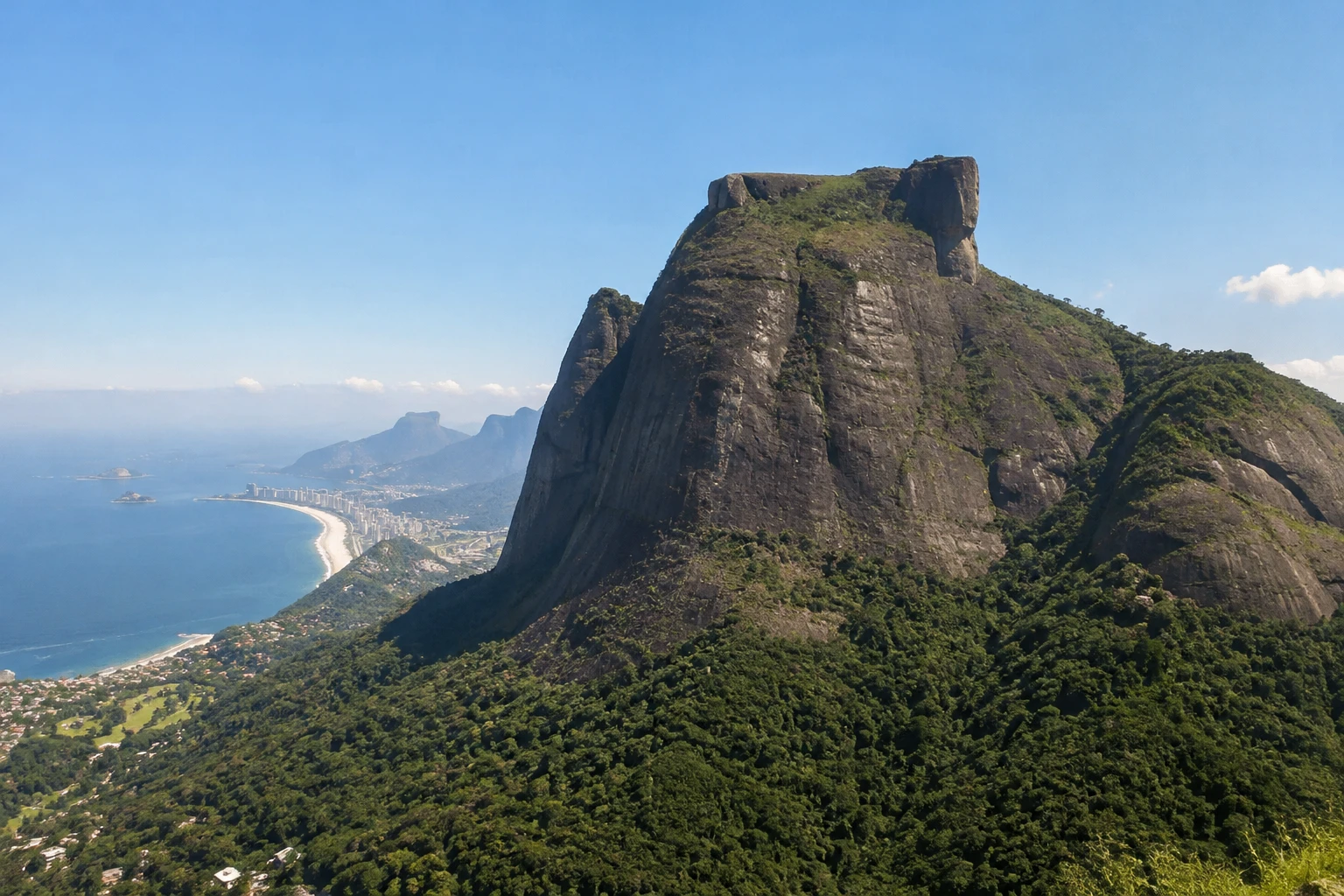
The Pedra da Gávea hike is a demanding Rio de Janeiro outing for strong, experienced hikers. It climbs more than 800 metres and includes exposed terrain, culminating in a high panorama across the South Zone, Southwest Zone and Tijuca Forest. The reward is substantial, but so is the commitment: this is a full-day mountain objective with a hands-on technical section, not a quick walk to a viewpoint.
- Treat Pedra da Gávea as a difficult, technical hike with more than 800 metres of elevation gain.
- Carrasqueira is a roughly 30-metre near-vertical scramble where hikers use their hands.
- Allow a full day. The ascent takes at least three hours, and average walking time is around five hours.
- The trail access is on Estrada do Sorimã in Barra da Tijuca. The summit cannot be reached by vehicle.
- Confirm same-day access conditions, weather-related restrictions, current entry rules and costs before setting out.
Is Pedra da Gávea the right hike for you?
This route suits hikers with strong conditioning who already understand demanding, exposed terrain. The long ascent, vertical rock sections and need to scramble mean enthusiasm alone is not enough. Go only if you are comfortable using your hands on rock, making careful decisions around exposure and sustaining a hard effort over several hours.

Rio Hang Gliding & Paragliding w/ Brazilian Champion 4k Video inc
Private flight with Brazilian Champion pilot + 4K GoPro video INCLUDED. Fly above Rio de Janeiro on a premium private hang gliding or paragliding ex...
Pedra da Gávea is a poor choice for a first hike in Rio, for anyone with limited balance or mobility, or for travelers with a severe fear of heights. It should also be avoided by those who expect an accessible attraction or a simple forest stroll. The route’s physical and technical demands deserve an honest assessment before you commit to the day.
Carrasqueira is the section that changes the calculation
The defining challenge is Carrasqueira, described by Riotur as an approximately 30-metre, near-vertical section where hikers need to use their hands. It is the point where ordinary trail fitness gives way to scrambling skill, calm movement and sound judgment. Do not treat it as a photo stop or a place to rush through because another group is waiting behind you.
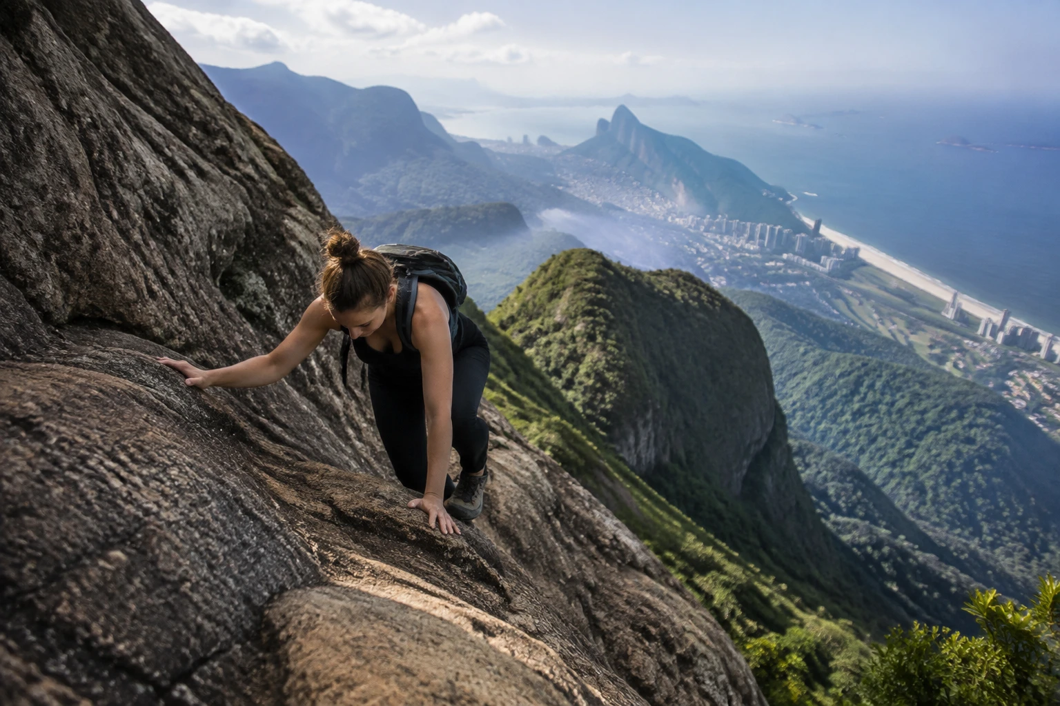
The exposed terrain is a serious safety issue, not just an adventurous flourish. The park information notes accidents, including fatalities, on vertical sections of the route. Build your plan around reducing avoidable pressure: hike with capable people, use the appropriate safety setup and turn back if the conditions or the group’s abilities are wrong for the route.
How long the Pedra da Gávea hike takes
Plan for Pedra da Gávea as a full-day commitment. Riotur gives a minimum of three hours for the ascent, while park information describes about five hours of walking on average. These figures describe different parts of the experience rather than a guaranteed door-to-door schedule, so leave a generous buffer for the descent, rests, the technical section and any delay on the trail.
- Keep the hiking day free rather than squeezing it between city sightseeing plans.
- Use the three-hour ascent minimum as a baseline, not a target to beat.
- Allow substantial extra time for descending and moving safely through exposed terrain.
- Confirm current entry and exit rules, same-day access conditions and weather-related restrictions directly with the park or ICMBio before departure.
Do not rely on old online gate times when planning this hike. Operational rules and weather-related restrictions can affect the day, and exact schedules need a current official check. This is especially important for a route where a late start can leave too little margin for a careful descent.
Reaching the Pedra da Gávea trailhead
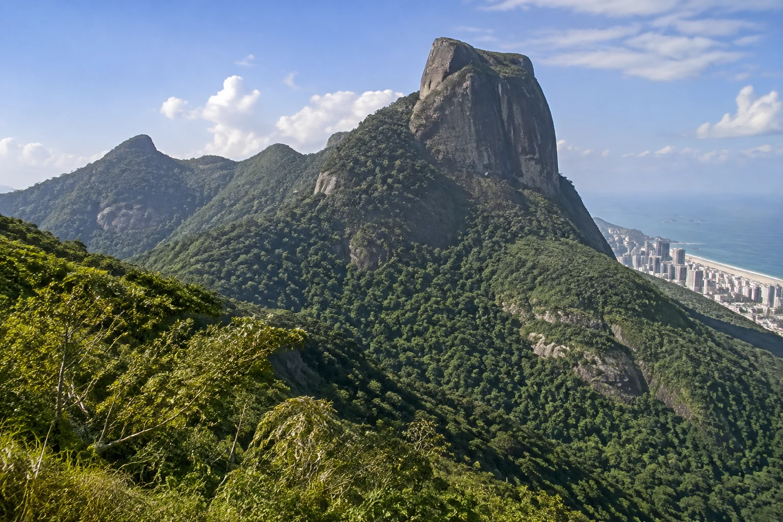
Use Estrada do Sorimã, Barra da Tijuca, Rio de Janeiro, as the trailhead location. This is the access road for the hike. It is not a road to the summit, so plan on completing the mountain section on foot and do not confuse a trailhead drop-off with a drive-up attraction.
Transport and parking arrangements need to be checked close to your hiking date. Do not build the day around an assumed bus route, ride-hail meeting point or parking setup. The Rio de Janeiro Itinerary Without a Car guide can help with wider city transport planning, but confirm the final connection to Estrada do Sorimã separately before you go.
Why an experienced guide or climbing-capable companion matters
Visitors without proven scrambling and technical-hiking experience should go with a qualified, experienced guide. Park guidance also recommends an experienced companion, groups of 10 people or fewer, and at least one person with climbing experience. Those are sensible minimums for a route where the hard part is not simply endurance but safely managing exposed vertical ground.
A guide is not a substitute for candid preparation. Before choosing one, ask what level of experience participants need, how group size is managed and how safety is handled at the exposed section. If you are relying on a companion instead, make sure that person has real climbing experience rather than general fitness or a few casual hikes.
Set your budget only after checking current information. Admission charges, parking terms, guide rates and reservation procedures were not provided in the official tourism and park material used for this guide, so costs and booking requirements should be confirmed before travel rather than assumed.

Sugarloaf Mountain Fast-Pass Ticket & Guided Tour
This 1-hour tour begins in front of the entrance to Sugarloaf Mountain, on the stairway below the “Teleférico Pã...
Private Custom Full-Day Highlights in Rio: Only the Best Sights!
Enjoy the most complete private day tour in Rio de Janeiro with flexible itineraries built just for you. Visit iconi...

Half-Day Tour: Christ the Redeemer, Selarón & Sunset at Sugarloaf
Spend an amazing afternoon visiting the best of Rio: Christ The Redeemer Statue atop Corcovado Mountain, Sugarloaf C...
Technical equipment and group preparation
The park information strongly recommends safety equipment including a harness, rope, carabiners and slings. These items reflect the seriousness of the exposed terrain. Equipment should be part of a controlled plan led by someone who knows how to use it properly; carrying a harness alone does not turn an inexperienced group into a technical hiking team.
- A harness
- A rope
- Carabiners
- Slings
- An experienced person who understands climbing and the equipment being used
Keep the group compact and make decisions together. A group of 10 or fewer is the park’s recommendation, but a smaller, well-matched party is often easier to manage on a steep route. Everyone should understand that stopping, slowing down or turning around can be the right call when the exposed section does not feel safe for the group.
What makes the summit worth the effort
The summit payoff is its scale. Riotur highlights the broad views over Rio’s South Zone, Southwest Zone and Tijuca Forest, giving the hike a perspective that is difficult to get from the city below. For more context on the surrounding green landscape, the Tijuca National Park Guide is a useful companion to this demanding mountain day.
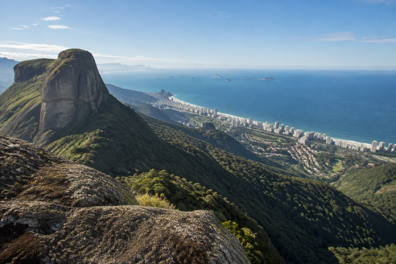
That panorama comes with a clear tradeoff: major physical effort, exposed terrain and a technical scramble. Travelers looking for a lighter outing should consider Pedra Bonita instead. Riotur describes that route as light and relatively easy, and the Pedra Bonita Hike Guide explains why it is a better fit for visitors who want a Rio viewpoint without Pedra da Gávea’s technical commitment.
Accessibility and a sensible alternative
Pedra da Gávea is not an accessible hike. Its steep ascent, hand-over-rock scrambling, exposed vertical ground and technical-equipment recommendations make it unsuitable for many travelers with reduced mobility, balance limitations or a strong fear of heights. Choose a lighter viewpoint experience rather than trying to adapt a route whose central challenge is its difficult terrain.
Pedra Bonita is the clearest lower-intensity alternative among Rio’s trails covered here. It is not equivalent to Pedra da Gávea in challenge or scale, which is precisely the point. A lighter, relatively easy trail allows more travelers to enjoy an elevated view without Carrasqueira or the demanding vertical sections that define this route.
The bottom line on hiking Pedra da Gávea
Hike Pedra da Gávea if you are fit, experienced on technical terrain and ready to treat safety as part of the achievement. Its mountain panorama over Rio’s zones and forest makes the effort meaningful, but the exposed ground and Carrasqueira are real limitations, not details to brush aside. Confirm current conditions, arrange capable support, reserve the full day and choose Pedra Bonita instead if the technical commitment does not match your experience.
Frequently asked questions
How difficult is the Pedra da Gávea hike?
Pedra da Gávea is a difficult, technical hike for strong and experienced hikers. It gains more than 800 metres and includes exposed vertical terrain, including the hands-on Carrasqueira scramble.
How long does the Pedra da Gávea hike take?
Allow a full day for the hike. The ascent takes a minimum of three hours, while average walking time is about five hours, with additional time needed for descent, rests and delays.
What is Carrasqueira on Pedra da Gávea?
Carrasqueira is an approximately 30-metre near-vertical section where hikers use their hands to scramble upward. It is the route’s key technical challenge and requires calm, capable movement on exposed terrain.
Do I need a guide for Pedra da Gávea?
A qualified guide is strongly advisable if you do not have proven experience with technical hiking and scrambling. Park guidance recommends an experienced companion and says at least one person in the group should have climbing experience.
Where does the Pedra da Gávea hike begin?
The access road is Estrada do Sorimã in Barra da Tijuca, Rio de Janeiro. It is the trailhead area, not a road that reaches the summit.
What should I confirm before hiking Pedra da Gávea?
Confirm same-day access conditions, weather-related restrictions, entry rules and any current costs before leaving. Check transport and parking details close to your hiking date as well.
Rio Hang Gliding & Paragliding w/ Brazilian Champion 4k Video inc
Private flight with Brazilian Champion pilot + 4K GoPro video INCLUDED. Fly above Rio de Janeiro on a premium private hang gliding or paragliding ex...
Experiences to explore
 Explore experience ↗
Pedra da Gávea trail, the most complete in Rio de Janeiro
◷ 6 hr
Climb the most complete and most desired trail in the city of Rio de Janeiro with a professional registered by the Ministry of Tourism,
See dates for Current pricing
View dates Explore experience ↗
Small Group Pedra da Gávea The Most Challenging Hike of Rio
◷ 8 hr
This activity is ideal for those looking for a real challenge. Almost at the end of the trail, there is a steep climbing section known
See dates for Current pricing
View dates Explore experience ↗
Pedra da Gávea Full Day Hike in Rio de Janeiro
◷ 7 hr
Conquer the challenging Pedra da Gávea trail for stunning views of Rio de Janeiro and its lush Atlantic Forest. This full-day adventure
See dates for Current pricing
View dates